Showing posts with label pedestrian. Show all posts

Wednesday, April 07, 2010

Congressmen Attack Walkers, Bicyclists and People Without Cars

Repost from walkroll.com:


Congressmen Attack Walkers, Bicyclists and People Without Cars

On March 12, the US Department of Transportation Secretary Ray LaHood said in a speech:

Where I’ve been in America I’ve been very proud to talk about the fact that people do want alternatives. They want out of their cars; they want out of congestion; they want to live in livable neighborhoods. This is the end of favoring motorized transportation at the expense of non-motorized. We are integrating the needs of bicyclists in federally-funded road projects. We are discouraging transportation investments that negatively affect cyclists and pedestrians. And we are encouraging investments that provide facilities for bicyclists and pedestrians of all ages and abilities.


On March 17, at a meeting of the Appropriations Subcommittee on Transportation, Housing and Urban Development:

Ohio congressman Steve LaTourette suggested LaHood was on drugs, dismissed the very idea of bike lanes and derided any change from a car-dependent society. He suggested that environmental sustainability projects have "stolen" $300 million from other programs and attacked LaHood's encouragement of bicycling.

Iowa congressman Tom Latham said that one biker is one less person paying into the transportation trust fund and said real transportation needs are being "swept aside."

These two elected officials are extremely important because they are on the Transportation, Housing and Urban Development committee and they decide where billions of tax dollars are spent. Tell the congressmen what you think of their comments. Their staff keep a tally of phone calls, so each call is important and will only take a minute out of your day.

LaTourette DC office: 202-225-5731
LaTourette Painesville office: 440-352-3939
LaTourette Twinsburg office: 330-425-9291

Latham DC office: 866-428-5642

Full report of LaTourette and Latham's comments here.

Full report of Secretary LaHood's comments here


In addition to the above two attacks:

- Missouri Senator Bond asked Secretary LaHood, "When did it become the responsibility of the federal DOT to build sidewalks?"

- Oklahoma Senator Inhofe criticized a draft bill as having "focused very heavily on transit, bike paths, and sidewalks."

- Alaska Senator Begich and South Dakota Senator Thune questioned whether livability is applicable in rural areas.

- Arizona Senator McCain introduced an amendment to a FAA bill that would strip funding for bicycle parking facilities

To find contact information for these and for your elected officials, go to VoteSmart. Make your opinions heard and help build a better America.

Thursday, March 11, 2010

Governor Steps In, Slightly, on Inner Belt Bridge

Old news, but I'm reposting for the record.

Repost from Cleveland.com:


Gov. Ted Strickland tells ODOT to rethink Inner Belt Bridge bike lane

By Reginald Fields, The Plain Dealer

March 09, 2010, 7:27AM
Inner Belt BridgeGov. Ted Strickland has entered the fray over an extra multipurpose lane proposal for the Inner Belt Bridge. The governor wants the Ohio Department of Transportation to study whether such a lane is possible in the renovation of the bridge.
COLUMBUS, Ohio -- Gov. Ted Strickland has jumped into the fray over whether to add a bike lane to the planned Inner Belt Bridge project, ordering the transportation department to study whether such a multipurpose lane is even feasible.
The Ohio Department of Transportation has said it already studied whether to add a lane for bicyclists and pedestrians and had decided against it for various reasons -- cost, maintenance and user safety, among them.
"But at the direction of the governor, we will take a renewed look," said Scott Varner, ODOT spokesman.
What would potentially be the narrowest lane across the $450 million bridge has drawn the biggest debate for politicians.
ODOT has said $85 million in federal stimulus money has already been allocated for the program, based on an environmental impact statement that did not include a bike lane.
To go back now and ask the Federal Highway Administration to revise the statement could put Ohio's federal funding in jeopardy, ODOT has contended.
That did not sit well with U.S. Rep. Dennis Kucinich, who last month wrote the highway administration asking it to allow ODOT to resubmit the impact statement without threat of losing funding. ODOT, meanwhile, did not relent.
Then last Thursday, U.S. Sen. Sherrod Brown took a different approach, writing to Strickland and urging the governor to get involved and ensure ODOT includes a multipurpose route across the bridge.
"It would be penny-wise and pound-foolish to build this bridge with only cars and trucks in mind," Brown wrote to Strickland.
"It is imperative that when construction begins on the new Inner Belt, a bike and pedestrian path is included," Brown said.
Bike enthusiasts have also been critical of the governor for talking about leading Ohio's emergence into a green economy but staying silent on a chance to support bicycling over environment-choking cars and trucks.
On Friday, Strickland's office asked ODOT to study whether a bike lane is possible, said the governor's spokeswoman Amanda Wurst. But the governor does not yet share Brown and Kucinich's conclusion that such a lane must be included.
Neither Wurst or Varner offered a time frame for when ODOT would complete its review.
ODOT is expected to choose the three design/build teams that will bid on the Inner Belt project on March 23 and award the contract in mid-September.

Wednesday, March 10, 2010

Biking Directions And Trails Added to Google Maps

This is great, and Cleveland is one of the cities included in this (http://bit.ly/cMesIH)
This  trail hierarchy is good, too. Excellent way of showing this on maps:

  • Dark green indicates a dedicated bike-only trail;
  • Light green indicates a dedicated bike lane along a road;
  • Dashed green indicates roads that are designated as preferred for bicycling, but without dedicated lanes


Repost from GoogleBlog:


Biking directions added to Google Maps

3/10/2010 05:00:00 AM
Whenever I meet someone who finds out that I work on the directions team for Google Maps, the first question I'm asked is often "So when's Google Maps going to add biking directions?" We're big biking fans too, so we've been itching to give you a concrete answer. I don't want to keep the good news a secret any longer, so the answer is: right now!

Today we've added biking directions and extensive bike trail data to Google Maps for the U.S. My team has been keeping close tabs on all the public support for biking directions that’s been steadily coming in, but we knew that when we added the feature, we wanted to do it right: we wanted to include as much bike trail data as possible, provide efficient routes, allow riders to customize their trip, make use of bike lanes, calculate rider-friendly routes that avoid big hills and customize the look of the map for cycling to encourage folks to hop on their bikes. So that's exactly what we've done.

Let's say you want to bike to work, or maybe you want to drive less and spend more time outdoors. Biking directions can help you find a convenient and efficient route that makes use of dedicated bike trails or lanes and avoids hills whenever possible. To find biking directions, select "Bicycling" from the drop-down menu when you do a directions search:


So, how does it work? Well, I'm based in Seattle, along with the rest of the biking directions team. The city is notoriously hilly, but also has some great trails and a strong cycling community. Let's say I'm trying to get from Golden Gardens to a friend's house in Montlake:


This route avoids hills (phew!) and puts me on the Burke-Gilman trail for most of the journey. When I need to get off the trail to cross town, biking directions makes sure to keep me on bike-friendly roads and avoid some of the city's busiest intersections. The time estimate for the route is based on a complex set of variables accounting for the type of road, terrain and turns over the course of my ride. If I decide that I want to stop at Woodland Park Zoo along the way, I can click on the blue path and drag it to my desired route — just like with driving directions — and we'll still customize the journey for cycling suitability. Over on the Lat Long Blog, you can read more about all the unique tweaks and calculations factored into our routing algorithm.

We've also added information about bike trails, lanes and recommended roads directly onto the map. This can help you get a better sense of your route, or let you find trails nearby for a recreational ride. When you're zoomed into a city, click on the "More" button at the top of the map to turn on the "Bicycling” layer. You'll see three types of lines appear on the map:
  • Dark green indicates a dedicated bike-only trail;
  • Light green indicates a dedicated bike lane along a road;
  • Dashed green indicates roads that are designated as preferred for bicycling, but without dedicated lanes


Thanks primarily to our partnership with the Rails-to-Trails Conservancy, we now have more than 12,000 miles of trails included in biking directions and outlined directly on the map. We also have data on bike lanes and recommended streets for 150 cities across the country. We'll continue to add new trail information and encourage riders to send feedback (biking directions is in beta, after all) and route information for inclusion via the “Report a Problem” tool. When Map Maker is available in the U.S., all riders will be able to directly contribute their local knowledge about trails, bike lanes and suggested routes.

We know that many of you have been anxiously awaiting this feature, so head over tohttp://maps.google.com/biking to try it for yourself and then hop on your bike!

Wednesday, March 03, 2010

Video: Bike and Pedestrian Access for All on a New Cleveland Innerbelt Bridge


Tuesday, March 02, 2010

Kucinich Steps in to Fight for Bike and Ped Access to Bridge

Repost from DC Streets Blog:

Kucinich Brings the Innerbelt Crossing Fight to D.C.

Today from Streetsblog Network member GreenCityBlueLake, an update on the push to include bicycle and pedestrian facilities on a reconstructed Innerbelt Bridge over the Cuyahoga River -- an accommodation that the Ohio DOT has been resisting. In the latest development, Rep. Dennis Kucinich has stepped up his involvement. From GCBL:
img_0135_large_225x300.jpgWill calls for a bike and ped crossing over the Cuyahoga River be heard? (Photo:Rustwire.com)
Congressman Dennis Kucinich (D-OH) met yesterday with members of the Cleveland Planning Commission, including director Robert Brown, to discuss the path forward to ensure that plans to replace the I-90 Innerbelt bridge include a separate roadway for bikes and pedestrians. “The State of Ohio should be encouraging opportunities for the people of Cleveland to cross the Cuyahoga River in a way that is good for public health, good for the environment, good for businesses, and good for communities,” Kucinich said.
A couple of weeks ago, we posted a music video that is part of the campaign to open the new Innerbelt crossing to bicycles and pedestrians. The video has gotten more than 14,000 views on YouTube. At that time, we didn't have the full credit info, but now seems as good a time as any to post it. From GCBL's Marc Lefkowitz: 
Ari Lesser wrote and performed the lyrics. He lives in Cleveland Heights. The musicians are Kip Volans, drums, and Jim Courtot, who did the recording in his studio and performed on the bass and guitar. The video and editing was done by Graham Veysey, who lives in Cleveland's Ohio City neighborhood. These guys all donated time and put this excellent video together in an incredibly short time.
Momentum seems to be building behind this effort. Will Ohio DOT be forced to blink? We'll keep you posted.

Thursday, February 11, 2010

Cleveland Planning Commission Report - 020510


Planning Commission Members
Gloria Jean Pinkney
Phyllis Cleveland
Norman Krumholz
Robert N. Brown
Anthony J. Coyne, Chairman - Absent
David H. Bowen
Lillian Kuri
Lawrence A. Lumpkin

MANDATORY REFERRALS


1. Ordinance No. 128 10 (Ward 17/Brady):
Designating McKinley Elementary School as a Cleveland Landmark

2. Ordinance No. 129-10 (Ward 17/Brady):
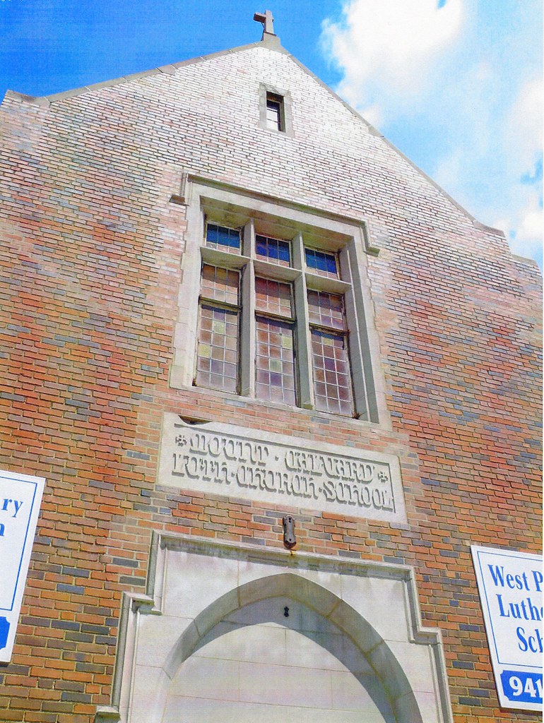
Designating Mount Calvary Evangelical Lutheran Church and School as a Cleveland Landmark


3. Ordinance No. 130-10 (Ward 17/Brady): 
Designating Nathaniel Hawthorne School as a Cleveland Landmark
The city, specifically Ward 17, now has three less buildings to worry about losing due to demolition. These three building all met the following criteria: 
Criterion 1 - Its character interest or values as part of the development, heritage, or cultural characteristics of the City, State, or the United States.
Criterion 4 - Its exemplification of the cultural economic, social, or historic heritage of the City.
Criterion 6 - Its embodiment of distinguishing characteristics of an architecture type or specimen
Criterion 10 - Its unique location or singular physical characteristic representing an established and familiar visual feature of a neighborhood, community, or City.
Out of three, Calvary is my favorite building. To many people it does not seem like it would meet the age requirement, having a somewhat modern look to it. In fact, the main church building (the youngest) was dedicated in June 1960. However, I believe the designation is actually going toward the school portion of the campus. One additional note: the church was NOT in favor of this designation. No reason was given. 
Motion to approve all - Passed.
ADMINISTRATIVE APPROVALS


1. Ordinance No. 8-10:
Authorizing the Director of Public Utilitiies to apply for and accept a grant from the Ohio Environmental Protection Agency to implement storm water Best Management Practices at the Kirby Water Pollution Control Facility to allow storm water to divert away from the combined sewers; determining the method of making the public improvement of constructing the improvement; authorizing the Director to enter into one or more public improvement contracts to construct the improvement; and authorizing the director to employ one or more professional consultant necessary to design the improvement.

2. Ordinance No. 134-10:
Determining the method of making the public improvement of rehabilitating, renovating, reconstructing, or otherwise improving the fuel system at the Division of Motor Vehicle Maintenance; authorizing the Director of Public Service to enter into one or more public improvement contracts to construct the improvement; and authorizing the director to employ one or more professional consultants necessary to design the improvement.
Motion to approve all - Passed.
DOWNTOWN/FLATS REGION DESIGN REVIEW

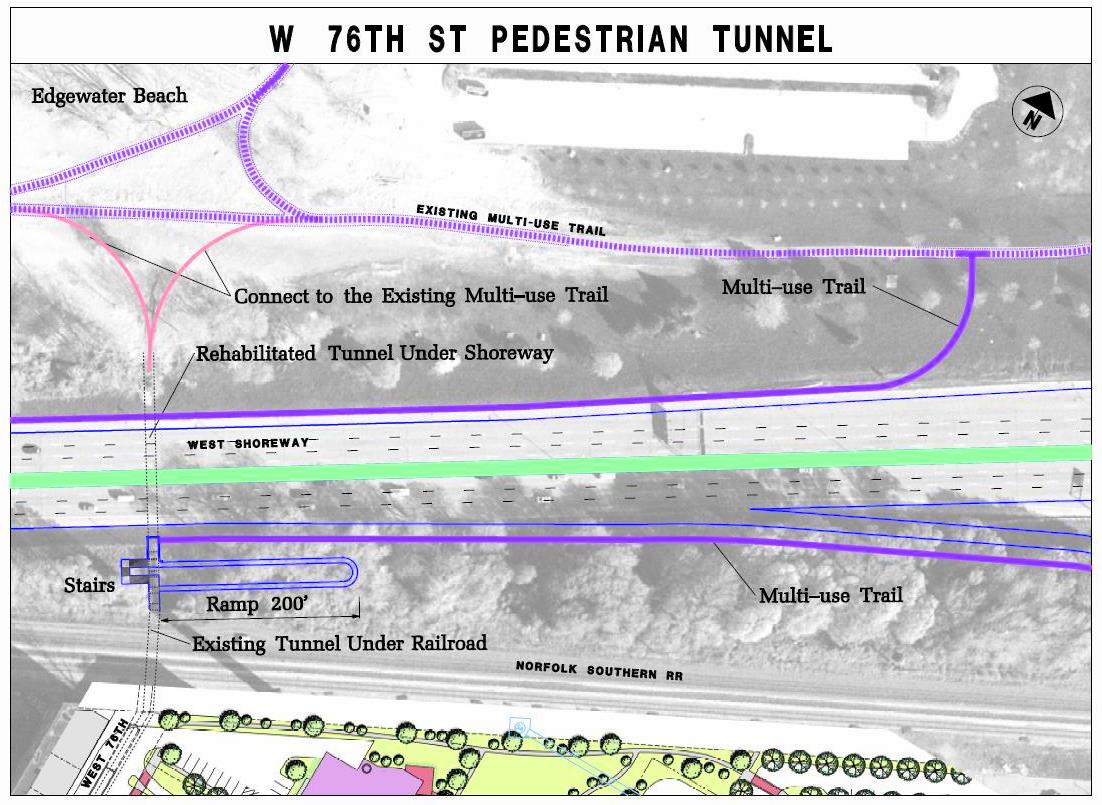
1. DF 2010-005: West Shoreway Project- West Shoreway, Lake Avenue and West 76th Street Pedestrian Access under Shoreway to Edgewater Park, Final Approval
(Ward 15, Ward 16)

Project Representatives: Craig Hebebrand, Ohio Department of Transportation; Natalie Conley, Ohio Department of Transportation; Kirsten Bowen, Michael Baker Jr., Inc.; Paul Volpe, City Architecture; John Spear, Vintage Development Group
Seeking final approval for what will be the official start of the West Shoreway downgrade from limited access freeway to a boulevard. The actual work will be the three pedestrian tunnels that run underneath the roadway. The first tunnel is located at Lake Avenue, and the second two are at West 76th Street. Both ramps will be reconfigured for ADA requirements and will be built in way that will allow more daylighting of said tunnels.
(note: The publishing of this report was delayed in order to obtain updated renderings. These are still not available and likely will not be until the public meeting on February 23. The original site plans from ODOT's project page are presented instead.)
Some of the design elements to be used on the $2.7 - 3 million portion of the Shoreway project include the same lights currently installed on the Detroit Superior  Bridge. There will also be a metal trellis system to allow for vertical growth of ivy type plants near the adjacent to the tunnel entrance. It is hoped this will be made from a high grade stainless instead of aluminum or similar material that might bleed rust on the concrete.
Councilman Zone spoke: He mentioned the desire to celebrate the completion of the tunnels this fall with a 100th anniversary party since the opening of the original tunnels. Although delighted with the most recent progress, he shares many of his constituents concerns with the many delays and postponements related to this project. He also agreed with Design Review comments regarding the relocation of the waterline that runs along the ceiling of the tunnel. Finally, he commented on how we should not settle for second best when it comes to materials used for the project and would like ODOT to examine the possibility the white porcelain tiles currently in various states of disrepair throughout the tunnel be restored.

Motion to approve - Passed.
2. DF 2010-006: CSU, Campus Safety Building, Remodeling, Final Approval 
1870 East 19th Street, Ward 8
Project Representatives: Tania Anochin, CSU;
Rick Ziska, Ziska Architecture
Cleveland State University is moving their police station, currently located behind the Chester Building in the Chester Building Annex, to the Baker's Union Building on the western end of the campus, off of East 19th street. The current entrance on the east side of the building will be sealed and a new entrance will be built on the north facade of the building adjacent to the parking lot. 

Motion to approve - Passed.
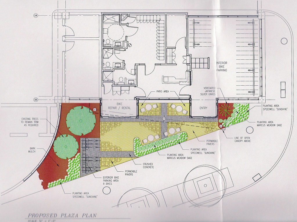
3. DF 2010-003 - Downtown Bike Station, Site Plan and Canopy Design
East 4th Street Gateway Garage (Ward 3)
Project representatives: Martin Cader, City Planning Commission; Steve Skidd, Architecture Division
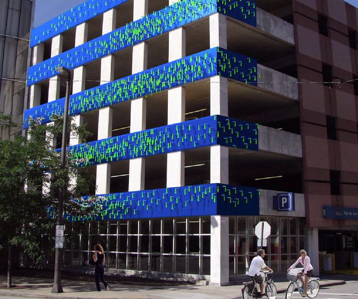
Presented changes to the already approved plan for the Downtown Bike Station located at the Gateway Garage. Changes were made to the planting plan due to buried utilities, as well adding space for outdoor biking. Commission members asked about the durability of the art component for the station. They were told testing is currently being done on the roof of City Hall.


DIRECTOR’S REPORT


1. ODOT Representatives and Planning Commission Dialogue regarding a Multi-purpose Lane on the New Inner Belt Bridge
(note: This portion of the meeting was conducted immediately after the presentation of the West Shoreway Pedestrian Tunnel project.) 
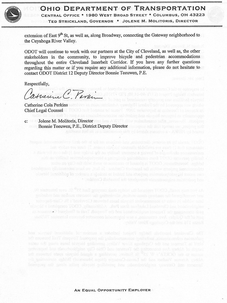
Director Brown discussed the letter reaffirming ODOT's decision not to allow the pedestrian/bike path component of the new innerbelt bridge to move forward. He presented the letter to Commission members from ODOT Chief Legal Counsel, Catherine Cola Perkins. (see below - click to view larger image)

A more concise report regarding the dialogue was written by Mark Lefkowitz. The following is a repost from GreenCityBlueLake.com:

What could you do with hundreds of professionals in 220 hours? Apparently ODOT thinks between now and March 2, it’s not enough to amend electronic documents that can vastly improve the future for Greater Cleveland’s citizens. The documents, which include ODOT’s environmental impact statement, would allow thousands to choose to ride a bike or walk on the new Innerbelt Bridge and catch views of downtown on the way to an Indians game or to dinner in Tremont.
“When you design a bridge, you don’t design it just for cars you design it for people,” Cleveland Councilman Matt Zone told ODOT Innerbelt Project Manager Craig Hebebrand at today’s Cleveland Planning Commission. “Why should the citizens of Cleveland settle for second class? We should demand (a multi-use path on the bridge) from the design phase. We should demand something better. Let’s see what the prices come in. In Shanghai and in Portland they are designing bridges for people.”
Hebebrand said it’s too late from ODOT’s perspective to make any changes. “There’s no way to physically amend the documents to add the addendum in time.”
Planning Commission member Lillian Kuri, however, got Hebebrand to admit that there will be many addendums to the Environmental Impact Statement before the end. Adding an addendum to that EIS for a bike/ped multi-use path now should not be used an excuse, Kuri said.
Advocates agree, and we charge that we have 25 days, or 220 hours until ODOT’s imposed March 2 deadline. We also contend that where there’s a will, there’s a way. The comments from Councilman Matt Zone illustrate this sentiment; and given Hebebrand’s assertions, it is perhaps proof positive that the issue transcends ODOT and its usual bureaucracy, and so it’s time move up the chain of command.
“If there’s a need for $20 million, I certainly cannot promise it, but we can advocate for it because it’s needed,” said Martin Gelfand, Senior Counsel for Representative Dennis Kucinich. “With all due respect to ODOT, planning bridges in the 21st century is not the same as in the post war when the Innerbelt was built. We can call it the dinosaur era because we were so dependent on fossil fuels. I think we need to get out of that dinosaur era and bringing people back into downtown. So this signature bridge should include the cyclist and include the pedestrians. Don’t say no, say ‘how’.”
Kuri asked Gelfand and Rep. Kucinich to hold a meeting with ODOT and Planning Commission director Bob Brown, which Gelfand agreed to. Observers note that the meeting will be meaningless unless we figure out the explicit action that has to occur—an amendment or waiver to the EIS, which, by the way, happens frequently with cooperation from the right parties at Federal Highway Administration—and the right people have to be in the room to take that action.
“It’s now or never,” Kuri concluded.

2. Cleveland-Cuyahoga Port Authority Representatives provide its Monthly Progress Report on Downtown Port Area Development

Director Brown stated there was not much to report in regards to the Downtown Port Area Development except to say they are moving into the second phase process of creating an RFP. The general plan is still to move forward with the move to the East 55th area of the lakefront.
Comments were made from some stakeholders:
Jim Cox: Acknowledged the December resolution calling for monthly updates. Questions the lack of updates.
Director Brown: It is only February. The port passed a plan of there own in response to resolution. They are now gathering data to be reported in future updates. 
Ken: Denounces current waterfront plans. Wants to know why the breakwall plans were not selected.
Krumholz: Agrees with the question; how did we get from the west-side location of the waterfront to the east-side seemingly overnight?
Other: Claimed Carney has property interest in waterfront area; Carney went to the Mayor and convinced him of the 55th site move. (He actually accused the Mayor of lacking intelligence enough to make the decision.)
Brown: Called out 'other.' (Put him in his place.)
Kuri: Suggested staff - Linda - take a further look at other possible locations.
Brown: Since a new port director has not been chosen, as well as any changes in his/her supporting staff, everyone should wait.

Thursday, February 04, 2010

BRIDGES ARE FOR PEOPLE TOO - ReBlog from Scene


BRIDGES ARE FOR PEOPLE TOO

POSTED BY FRANK LEWIS ON THU, FEB 4, 2010 AT 11:28 AM

Cleveland’s small but lately tenacious Critical Mass crew has not yet made the Innerbelt Bridge a part of their monthly bicycle ride (which they note does not block traffic, but shows the motoring world that they are part of traffic). But one wonders what it would take for anyone who is not driving a car or truck to get any consideration from the massive load of bureaucratic inertia that is ODOT.
Cyclists and alternative transportation advocates have for years been attempting to persuade the state transportation agency to include a multipurpose path — separate from the motor vehicle lanes — on the planned new Innerbelt Bridge. Such a path would offer bicycle and foot commuters — and even people who just come to check out what will be stunning views — equal access to what will be one of the most expensive transportation projects in the state.
And they are not alone: The City of Cleveland Planning Commission has steadily supported the idea, to the point that late in January they approved a resolution supporting the inclusion of such a path in ODOT’s request for proposals. Among the many other supporters are former Cleveland Planning Director and Jane Campbell chief of staff Chris Ronayne, industrialist Dan T. Moore, and Congressman Dennis Kucinich. But the RFP went out earlier this week without indicating that bidders on the $450 million design/build contract should include bike/pedestrian lane in the plan.
But since the design has not yet been chosen, the game is not over, says Ohio City Bicycle Co-Op director Jim Sheehan. He’s encouraging supporters to come and make themselves heard Friday morning (February 5) when ODOT officials will attend the Planning Commission meeting.
If you think a half-billion-dollar “signature bridge” connecting Tremont to Downtown — which would have spectacular views of the city, river valley, and Lake Erie, and which will connect two of Cleveland’s most attractive neighborhoods — ought to offer equal access for all, including the one-out-of-four Clevelanders who don’t own cars, then this is the meeting for you. It’s at 9 a.m. Friday, February 5 at City hall Room 514. For background on how badly ODOT has managed this project, check out this recent installment of WCPN'sThe Sound of Ideas. — Michael Gill

Sunday, January 24, 2010

Cleveland Planning Commission Report - 012210


CLEVELAND CITY PLANNING COMMISSION

Planning Commission Members

Anthony J. Coyne, Chairman
David H. Bowen
Lillian Kuri
Lawrence A. Lumpkin
Gloria Jean Pinkney
Joe Cimperman
Norman Krumholz
Robert N. Brown 
All present 
LOT SPLIT
  1. LS 10-001:1969-71 East 123rd Street, 80’x75’ lot for Margarita Trivisonno (Ward 9)
There are two houses currently on this single parcel: a 5/5 in the front and a 3/3 in the rear. The current owners would like to split their current lot for tax reasons. There is one tax on the parcel and they feel it is difficult to equitably split this. if there are two parcels, then they would be taxed on their individual appraisal.


The Commission motioned and approved to table this until the owners have a chance to better explore their options. It was suggested there may be a better way of resolving their financial issues. The Commission also requested legal documentation establishing proper easement rights to the rear portion of the parcel
MANDATORY REFERRALS


1. Ordinance No. 29-10:  To amend Section 347.02 of the Codified Ordinances of Cleveland, Ohio, 1976, as enacted by Ordinance No. 1562-08, passed February 2, 2009, relating to restrictions on the keeping of farm animals and bees.

This item was brought before the Commission to fix a some of the wording in the legislation previously approved February 2009 so the Building and Housing Department isn't clogged up approving plans that call for simple coops for bees, chickens, and other farm animals. Anything other than small coops will still need to be approved. Motion to approve - passed


2. Ordinance No. 1268-09 (former Ward 3/New Ward 6/Mitchell):  An emergency ordinance authorizing the sale of real property as part of the Land Reutilization Program and located  11300 Kinsman Road to Greater Friendship Baptist Church.

This was originally submitted by the former councilperson under the impression the lot would be improved with parking for the multi-family structure adjacent to  the property. The application was originally submitted proposing open space and the applicant told the planning staff subsequent to the legislation introduction that it is NOT his intention to develop a parking lot. The current councilperson does not support the legislation to sell if it is not for a parking lot.
Motion to not approved - passed.

3. Ordinance No. 13-10 (Ward 15/Zone):  Authorizing the Director of Parks, Recreation and Properties to enter into a property adoption agreement with the Detroit Shoreway Community Development Organization to maintain the Gordon Square parking lots known as Kennedy Lot and CPT Lot.

This will enable the Detroit Shoreway Community Development Corporation the responsibility of maintaining parking lots servicing the Gordon Square segment of Detroit Avenue. Motion to approve - passed.
4. Ordinance No. 14-10 (Ward 2/Reed):  Authorizing the Director of Parks, Recreation and Properties to execute a deed of easement granting to AT&T certain easement rights in property located near the northeast corner of East 136th Street and Harvard Avenue and declaring the easements rights no longer needed for public use.
Withdrawn.
NEAR WEST REGION DESIGN REVIEW

1. NW 2010-001: Battery Park Skyline Townhomes – New Construction 
1240-1268 West 73rd Street, also Addresses on Father Frascati Avenue, West 74th Street & Marina Court yet to be Determined


Project Representatives – Mike Marous, Vintage Development Group; Mike Caito, City Architecture


Description: Construction of twenty-four (24) new Skyline-style residential townhomes as part of Battery Park project’s Phase II component.  


This is part of phase 2 of the Battery Park neighborhood plan. The proposed 24 units are approximately 1600 square feet each and are priced between $250k - $300k each. The exterior will be mainly metal, brick and glass - the glass windows will be over sized to take advantage of the views.


Other related news - still working with ODOT to hammer out details of the West 73rd curve leading to the West Shoreway. This will likely add more usable space for the neighborhood. Work on the West 76 Street tunnel is set to start this spring. $1 million has already been set aside for these improvements.


To review the applicant’s submittal, please use the following link: http://planning.city.cleveland.oh.us/ftp/SkylineTownhomesSettotheCity.pdf

Motion to amend the previous PUD from a loft style building to the proposed townhomes - passed.


DOWNTOWN/FLATS REGION DESIGN REVIEW
1. DF 2010-001 - Cleveland State University, The Corlett Plaza, Revised Interim Site Improvements
1935 Euclid Avenue (Ward 3)


Project Representatives – Tania Anochin, CSU; Anne Hartman, Ralph Tyler Cos.


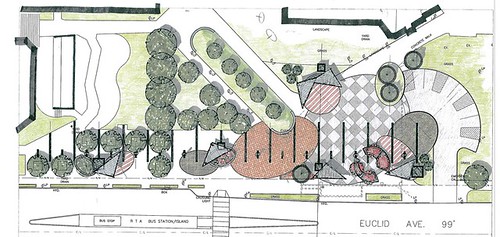
This is a revised site plan for Corlett Plaza - former site of the Corlett Building which was demolished last year. The new plaza will be constructed using 'green' methods, including a rain garden and permeable pavement. All rain runoff is planned to be managed on site with no connection to the sewer system. There are five awnings planned that will allow for rain to run of into raised flower beds.


CSU will continue to have a weekly farmers market in season. The new layout will allow for 52 stands including space for temporary parking for each purveyor as well as power for each stand. A public toilet will be constructed that was originally planned to connect with university's sanitary sewer system, but Design Review and the Planning Commission both encouraged CSU to look into the possibility of a 'composting toilet.' Bike racks will also be available.


The question was raised by Chairman Coyne regarding the long term plans for the site. CSU responded by stating the current proposal is considered a long term, interim plan. However, the university's Master Plan (pdf) still calls for a performance/visual arts center of some kind. Not sure how this will fit into the university's recent proposal to purchase a building at 1901 East 13th Street for the Art Department. 


Motion to approve - passed.


2. DF 2010-002 - Cleveland State University, Demolition & Site Improvements, The 1910 Euclid Building (Ward 3)
Project Representatives – Tania Anochin, CSU; Anne Hartman, Ralph Tyler Cos.


This proposal calls for the demolition of a building located at 1910 Euclid  Avenue (see previous mention here) and site improvements. The plan continues the general design of the Corlet plaza across the street. This is scheduled to be complete this year and is already out to bid.


Motion to approve - passed.


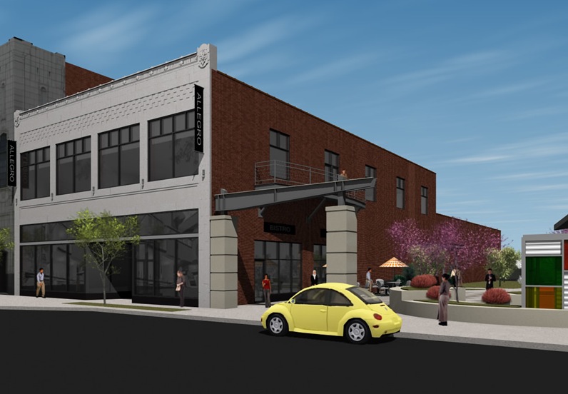
3. DF 2009-066-a - 1936/38 Euclid Avenue, Exterior Renovation, Side Wall Treatment (Ward 3)
Project Representatives -  Damon Taseff, Allegro Realty Advisors; Paul Beegan, Beegan Architectural Design


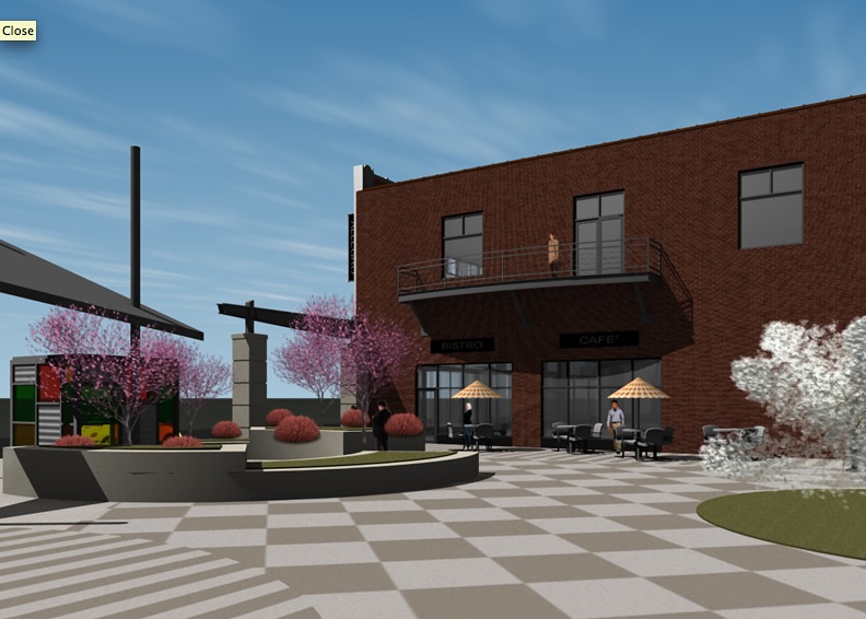
This building, formerly the Morse Graphics Building is currently empty and being renovated for possible future use. The proposed plan is to add windows to the first and second floors on the side wall adjacent to the plaza in the previous plan. (see above)


Motion to approve - passed.


EUCLID CORRIDOR REGION DESIGN REVIEW

1. (2010-002) - MCCo Chiller Plant
Medical Center Company, Jae Cho
CBLH Deign


The hospital proposes to build an additional chiller plant adjacent to the existing chiller plant.


Motion to approve - passed.


DIRECTOR’S REPORT
Draft Resolution Calling for Bike and Pedestrian Access to New Inner Belt Bridge

A much more detailed report this was written by Mark Lefkowitz on GreenCityBlueLake:
After months of working in the trenches to re-imagine an Innerbelt Bridge with access to all (with a bike/pedestrian path and scenic overlook with panoramic views of the city), cycling and sustainability advocates took another step forward today as the Cleveland Planning Commission approved a resolution of support.
Commission member and former director of Cleveland Public Art (where she fought the battle to put a bike lane and promenade on the Detroit-Superior Bridge) Lillian Kuri led the charge that ODOT include language inviting alternative designs including a multi-purpose path atop the bridge as part of its Request for Qualifications bid packages. Commission members Anthony Coyne and David Bowen agreed that an alternative in the sealed bid process would invite engineering firms to provide a design for a bike/ped path.
Continue reading the rest of the post here:


City Planning throws weight behind open access for Innerbelt Bridge