Pretty cool stuff, although it would be better if they had a map with color codes reflecting the flow of traffic. And if you were able to view that data on your cell or berry. I imagine that will come soon as part of the Innerbelt Project.
It will also give you Amber Alert information.
****UPDATE****
Dan said...
"Here's Cleveland traffic data mapped from Clear Channel Traffic. They get data from Cuyahoga County Emergency Service, traffic cams and phone calls."
Thanks, Dan.
I knew about the traffic cams site (I watch them from my windowless cubicle all the time), and I remeber seeing the mapped data before but forgot about it. I think I was thinking of something like L.A has, which is run by SigAlert.
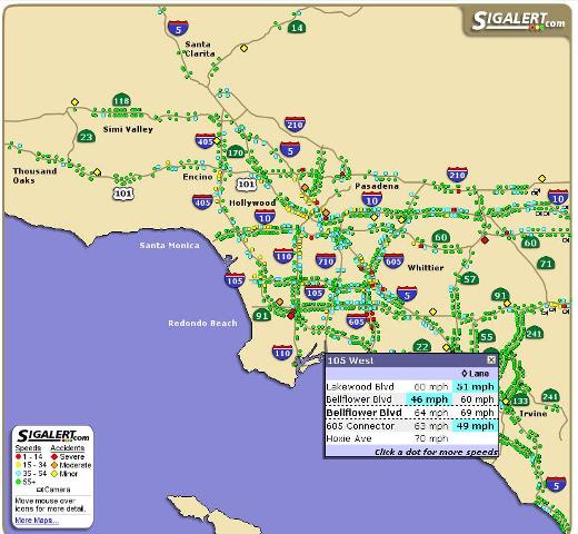
You can see the live data by going to
http://www.sigalert.com/map.asp?Region=Greater+Los+Angeles
The live traffic data they have is free. If you want personalized data, want to view the web cams, or have an alternate route laid out for you so you can avoid the traffic then you have a fee of $20 a year - which is not cool, but I guess they are a private company and can charge whatever they want. Here is a screenshot of traffic from this morning:


2 comments:
Here's Cleveland traffic data mapped from Clear Channel Traffic. They get data from Cuyahoga County Emergency Service, traffic cams and phone calls.
Thanks, Dan.
See updated post.
Post a Comment